
What Is a Country? Borders, States and Geography
Understand what country, state and territory mean, why country lists differ, and how to use UN sources for geography study and research.
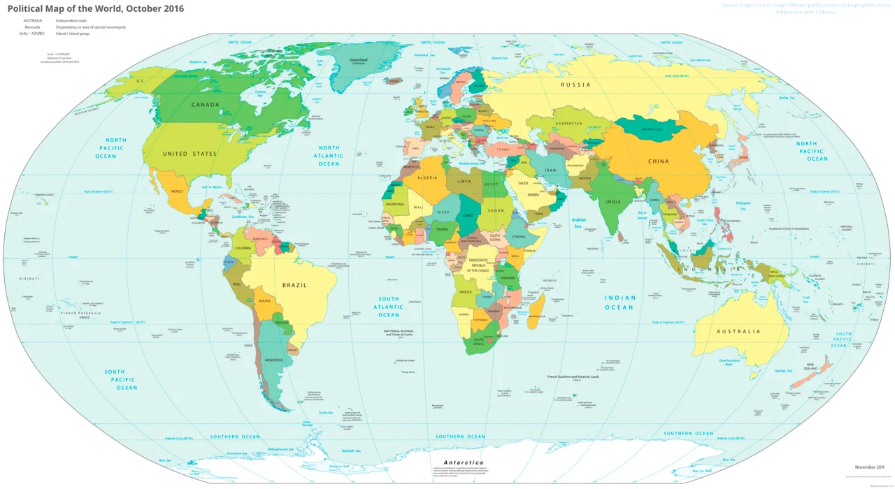
A country is a named geographical and political community, but the word can refer to different kinds of places in everyday speech. To understand a particular example, separate territory, government, identity and international status. That distinction explains why a world atlas, a sporting competition and a United Nations list may contain different entries without answering exactly the same question.
Political geography studies how places are organised and governed. Physical geography examines features such as rivers, mountains and climate. Both help explain a country, but neither a coloured shape on a map nor a shared language settles every question about sovereignty. A useful country profile identifies the definition it uses before presenting a count or comparison.
What is the difference between a country, a state and a nation?
A country is a broad everyday geographical term. A state concerns an organised political entity and its authority, while a nation describes a community associated with shared identity, history or culture. These meanings can overlap, but they are not interchangeable in every historical, constitutional or international context.
The word state is especially easy to misunderstand. In an international discussion it may refer to a sovereign political entity. In a federal system it may also describe an internal unit. A province or district is another type of administrative division, whose powers depend on the relevant constitutional arrangement.
A nation need not fit neatly inside a single border. People can share a cultural identity across several territories, while one political state can include many languages and identities. Avoid assuming that every country has one language, one religion or one uniform way of life.
When reading an examination question, identify the intended meaning from its context. “Name the states in this federation” differs from “Explain relations between states.” If the context remains unclear, define your usage in the first sentence. That makes the rest of the answer easier to assess.
Does the United Nations decide which places are countries?
The United Nations has a defined membership system, but membership and recognition are different concepts. Its own membership explanation states that recognition is granted or withheld by states and governments. Therefore, a UN membership list is an institutional record rather than a complete definition of every use of the word country.
The consulted UN materials describe 193 member states and two observer states, the Holy See and the State of Palestine. Keep the categories separate when explaining that count. A statement about members should not silently combine observers, territories and other entities under the same heading.
Admission procedures involve institutional decisions under the UN Charter. This does not mean the organisation operates a simple worldwide naming office that creates every country's political status. Membership, diplomatic recognition and the way a territory is administered remain distinct matters.
For a school assignment, state the list and its purpose. “This table uses UN member states” is clearer than “This is the only possible list of countries.” If you include additional categories, label them in separate rows and explain the selection rule.
Counts need a question
Ask what is being counted: sovereign states, members of an international organisation, sporting teams or statistical areas. An answer without a category is incomplete even if its arithmetic is correct. Definitions do more work here than memorising a total.
Why do world maps show different borders or names?
Maps are designed for particular purposes and dates, and they simplify complicated geography. Their labels, boundary symbols and scale determine what they can show. Differences may reflect an update, a naming convention or a territorial dispute, so read the legend and explanatory notes before drawing political conclusions.
International borders separate political jurisdictions in the map's chosen representation. Administrative boundaries show internal divisions. A thin grey line and a dashed international line may look similar on a small screen, yet mean different things. The map legend is the key to reading them correctly.
The UN's mapping guidance includes disclaimers about the status of boundaries and names. Such notes remind readers that displaying a line does not necessarily settle its legal acceptance. Preserve relevant notes when using a map in a presentation instead of cropping them away.
An official name can differ from a common name. A formal document may prefer the longer version, while a classroom atlas uses a familiar short form. Neither difference alone proves that the source describes another place. Check spelling, context and the source date before making that judgement.
Map scale also matters. A small-scale world map cannot show every coastal inlet, island or internal boundary. Zooming into a low-resolution image does not create more accurate data; it only enlarges the simplified representation.
How do you describe a country's location accurately?
Begin with its continent or broad region, then describe neighbouring land and water features. Use latitude and longitude when precise coordinates are relevant, and distinguish a capital city from the wider country. Location becomes useful when it explains connections, distances or environmental conditions rather than merely supplying labels.
A landlocked country has no direct sea coastline. A coastal country may still have inland regions far from ports. These distinctions can help explain transport routes, but they do not automatically determine wealth, culture or development. Geography creates conditions that interact with infrastructure and political choices.
A continent is not the same kind of unit as a country. A region may group places according to climate, history, economy or an institution's statistical method. Always state which grouping you mean when a label could have several interpretations.
For a classroom exercise, describe an imaginary place in three steps: its broad location, its neighbours and its main transport connection. Then remove unnecessary adjectives. A sentence such as “It lies inland, west of the river basin, and connects to the coast by rail” conveys more than an unsupported claim that the location is strategically perfect.
Avoid misleading directional shortcuts
Terms such as east, west, north and south require a reference point. “North of the capital” is clearer than “in the north” when the area could cross several regions. Add a map where the relationship would otherwise be difficult to understand.
Are citizenship, nationality and population the same thing?
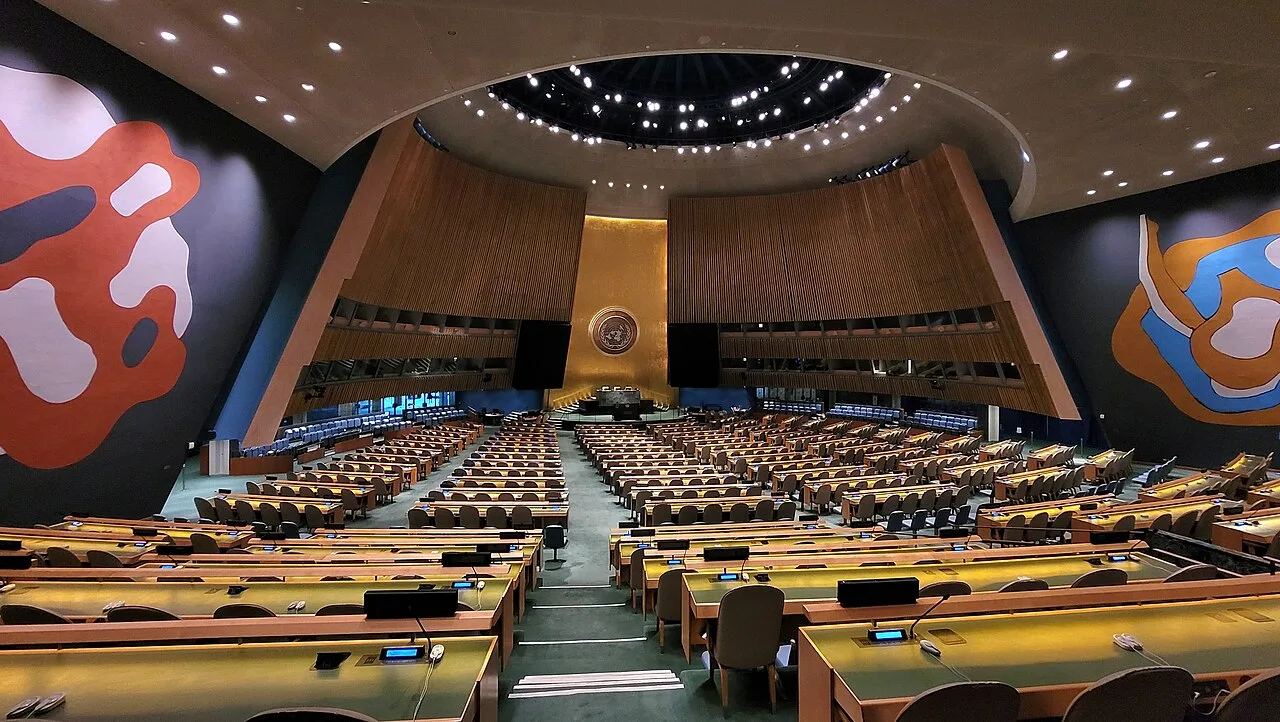
The General Assembly hall photographed in February 2024, illustrating the institutional setting behind UN membership lists.
Citizenship, nationality and population describe related but distinct ideas. Citizenship concerns a legal relationship under a state's rules; nationality can carry legal or identity meanings depending on context. Population statistics count people according to a specified method, which may include residents who are not citizens.
Resident population and citizen population should therefore not be treated as identical. Migration, temporary residence and the reference period can affect a dataset. Before comparing two figures, check whether both count the same people and use the same statistical year.
A census provides information collected under a defined method and date. A later population estimate uses additional assumptions and evidence. Present the label accurately: an estimate should not be described as a new census merely because its publication date is recent.
Population density divides population by land area. A hypothetical population of two million over 10,000 square kilometres gives 200 people per square kilometre. That average does not show whether most people live in one urban centre while large rural areas remain sparsely settled.
Treat national averages as summaries rather than descriptions of every individual. A country's most widely spoken language does not establish what every resident speaks. A population statistic is useful when its limits are understood, especially in comparisons of diverse societies.
What is a territory, and why is it not always listed as a state?
Territory refers to an area of land or jurisdiction, while political status describes how that area is governed and related to other entities. A dependent territory, an internal administrative unit and a disputed area can all appear on geographical lists for different reasons. Their inclusion does not give them identical status.
A statistical service may need a separate entry for a territory because it collects distinct data. A sporting body may recognise a team for reasons tied to its own membership rules. A postal system may assign a country code or routing label to support delivery. These are practical classifications with specific purposes.
Do not infer sovereignty from a dropdown menu. Software often uses country as a convenient interface label for countries and territories together. That design decision is not evidence of diplomatic recognition, nor does it establish the correct wording for an academic discussion.
When comparing lists, create a category column before counting entries. Mark members, observers, dependencies or other areas according to the source. If the source does not explain a category, record the uncertainty rather than invent a status from the shape or colour of its map.
| List type | Main purpose | What inclusion does not prove |
|---|---|---|
| UN membership list | Institutional participation | Every everyday meaning of country |
| Statistical area list | Comparable data collection | Identical political status |
| Sports team directory | Competition administration | Diplomatic recognition |
| Address form | Deliveries or account handling | A legal position on sovereignty |
How can you build a reliable country profile?
Build the profile around clear categories: location, governance, people, economy and environment. Give dates for changing figures and define the population or territory covered. A short, well-labelled profile is more useful than a long collection of facts copied from incompatible sources and years.
Start with a map and two sentences explaining location. Add the capital city and distinguish it from the largest city if your source makes that distinction. For governance, describe the institutional arrangement at the level your task requires without guessing the powers of individual offices.
For economic information, separate a currency from an exchange rate. A currency is the unit used for money; an exchange rate states a value relative to another currency at a particular time. Neither by itself shows purchasing power or household living standards.
Record units consistently. Land area should state square kilometres or square miles. Population should state persons or millions, and financial totals need a currency and reference year. Mixing raw figures with figures in millions can create enormous errors while leaving the table looking tidy.
Add an evidence note for every changing indicator. A useful entry records the figure, statistical year, publication date and definition. This small habit makes later updates easier because another reader can see exactly what needs replacing.
A practical source worksheet
Use one row for each fact and columns for wording, source, date and limitation. For example, a population entry may note that it is an estimate for residents. A climate entry may describe a long-term pattern rather than today's weather. The limitation should clarify the fact, not overwhelm it.
How can students compare countries without creating stereotypes?
Compare specific measures using the same definitions, units and time period, then explain what those measures cannot show. Avoid turning averages into claims about individuals. A respectful comparison asks how places differ on the selected question rather than ranking whole populations as better or worse.
Choose a focused question such as transport access, settlement patterns or school geography. Three comparable indicators are usually more instructive than twenty unrelated statistics. Explain why each indicator belongs in the comparison and what additional context would change the interpretation.
If one source reports a national total and another reports an urban sample, stop before calculating a difference. The figures do not describe the same population. Likewise, a figure from one year should not automatically be interpreted as evidence against a figure collected several years earlier.
A useful paired assignment gives two students the same country names but different source types. One uses a map and membership list; the other examines a statistical profile. Ask each student to identify what their sources can answer. The comparison demonstrates why no single webpage supplies every kind of geographical truth.
Finish with a paragraph that separates observation and explanation. “The listed population density is higher” is an observation supported by comparable data. “Everyone prefers city life” is a much larger claim that the density measure cannot establish. Careful country study depends on recognising that difference.
Before submitting, check names, units, legends and dates once more. Make sure each comparison uses the same geographical coverage. If the profile includes a disputed area, use neutral, attributed wording and preserve the source's status note. These checks improve both accuracy and the reader's confidence in the reasoning.
The result should help someone locate the place, understand the categories and interpret the evidence. Memorising a count is only a beginning. The more transferable skill is knowing what was counted, why that definition was chosen and how another source might organise the same world differently.
One final exercise is to audit an existing classroom poster. Circle every number that lacks a year, underline every label that could describe more than one category, and mark any border whose meaning is unexplained. Then rewrite three entries so a new reader could interpret them without asking the author. This is a useful test of communication as well as geography. It often reveals that the most important improvement is a clearer heading or unit, rather than another fact. Keep the original version beside the revision so the class can see how definitions change the usefulness of the information.
Apply these categories to real examples through the Qatar country profile, the India geography guide and the Zimbabwe country context. Compare how each describes location and evidence before adding statistics. The purpose is to practise one method across different places, preserving each source’s dates and definitions rather than assembling a mixed list of apparently comparable facts.
Sources
Source 1, Source 2, Source 3, Source 4
Image credits: Cover: w:The World Factbook ( w:Central Intelligence Agency ), source, Public domain. Resized and converted to WebP. Article image: Mojnsen, source, CC BY-SA 4.0. Resized and converted to WebP.
Result dates, fees and eligibility must be checked against the issuing authority's current notice. Report a correction with the article URL and original source.