
Lanka and Sri Lanka: Names, Geography and Context
Understand the use of Lanka and Sri Lanka, locate the country correctly, and distinguish geographical names from shortened cricket and travel searches.
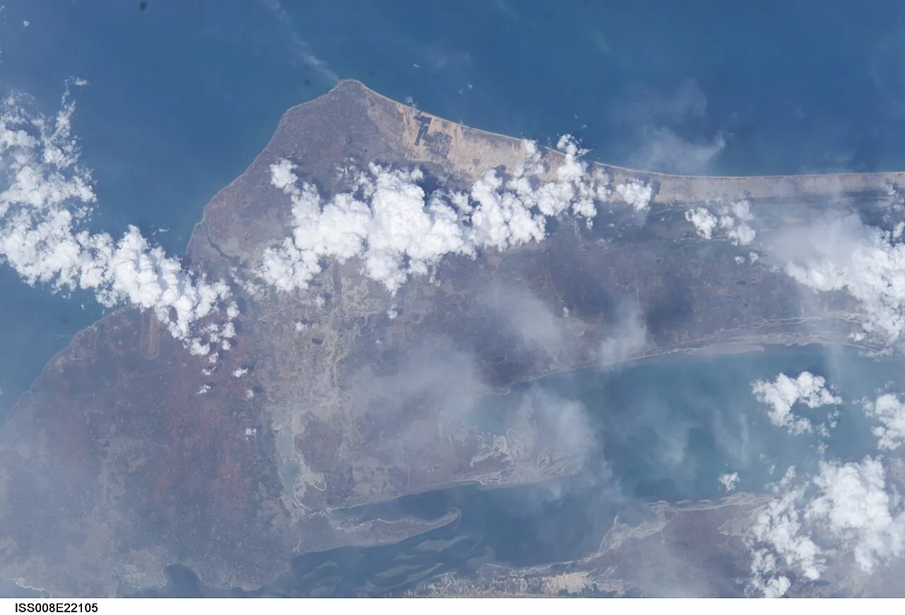
Lanka usually refers to Sri Lanka when the surrounding discussion concerns the modern island country, its places or its cricket team. A useful explanation begins by identifying that context. The same short search can lead to historical names, a literary reference or an organisation, so the word alone does not establish the subject.
For students, a strong Sri Lanka country profile connects a map with carefully chosen descriptions. Knowing where an island lies helps explain coastal routes, differences between inland and seaside landscapes, and its position within South Asia. It prevents a neighbouring country, a sporting team and a cultural tradition from becoming interchangeable descriptions.
This article concentrates on geographical understanding and responsible use of names. Its questions can support a school assignment, improve general knowledge or clarify a search result. The aim is a profile in which every label has a purpose and every changing figure carries a date.
Does Lanka mean exactly the same thing as Sri Lanka?
In modern conversation, Lanka can be shorthand for Sri Lanka, especially when the topic already identifies the country. For formal writing, use the full country name on first mention. In historical or literary discussion, establish what the particular source means before substituting a modern political name.
Consider three invented search phrases: “Lanka coastline,” “Lanka batting order” and “Lanka in an epic.” The first suggests physical geography, the second a cricket team, and the third a textual tradition. Adding one qualifying word changes the research question. Recognise that difference before collecting facts from search results.
Ceylon appears in older English-language records and survives in some established product or institutional names. It can help locate archival material, but it is not the default label for a new country introduction. Preserve the original wording when recording an archive title and explain its historical setting in your own text.
Treat a name as evidence about a document as well as its subject. An older label may suggest a period or intended audience, but cannot independently establish when a document was written. A modern publication may deliberately discuss historical terminology.
A useful note-taking method has two columns: the exact wording encountered and an explanation of its use. This keeps a literary place name separate from a modern national border without inventing a claim about how either developed. It also helps you quote accurately when several sources use different spellings.
Where is Sri Lanka on a South Asia map?
Sri Lanka lies in the Indian Ocean near the southern end of India. On a regional map, identify India first, then locate the island to its southeast. Label the surrounding water and inspect the narrow maritime area between the countries before concentrating on individual towns or attractions.
The Palk Strait and Gulf of Mannar add precision to this exercise. These labels communicate more than “below India,” which depends on a map's orientation. North, south, east and west describe geographical direction; the top and bottom of a phone screen describe presentation.
Begin with a political map showing country boundaries, then compare a physical map showing relief. These answer different questions. One shows territorial divisions, while colour shading on a relief map can distinguish lowlands from higher ground. Neither becomes a rainfall map merely because its surface uses several colours.
Read the map legend before interpreting a symbol. A thick line could show a national border, a major road or a river basin boundary, depending on the key. The same principle applies to dots representing cities, airports or archaeological sites.
A scale bar belongs on a location sketch if distance matters. Latitude and longitude help identify locations consistently, but they do not explain the meaning of the symbols around them. For a Pakistani classroom, a regional inset showing Pakistan, India, the Indian Ocean and Sri Lanka provides useful orientation.
Use that inset to discuss regional geography without assuming proximity creates identical political systems or cultures. The map supplies spatial relationships. The social and historical relationships require additional, appropriately chosen evidence.
Why do Colombo and Sri Jayewardenepura Kotte both appear in profiles?
Country descriptions distinguish Sri Jayewardenepura Kotte as the administrative capital and Colombo as a commercial centre. Preserve the source's functional labels when answering a capital-city question. An itinerary, business address and school table may emphasise different roles, even when discussing places within a closely connected urban region.
The official tourism profile separates administrative and commercial functions. This demonstrates why adjectives matter. A search snippet that drops one can create an apparent contradiction where the full source describes two different responsibilities.
Write the longer place name carefully. Unexplained spelling changes can make a reader think that two references identify different places. Check the published form, keep it consistent and mention a recognised variant only if it helps locate or understand another source.
A city, an urban area and an administrative division need not cover the same territory. A population total for municipal boundaries should not be compared directly with a wider metropolitan total. Record the geographic unit alongside the census year.
Imagine two sample tables: one counts people inside a city boundary; another includes surrounding settlements. A higher second total does not prove the first is wrong. Draw two nested outlines to show why coverage changes the result before discussing whether either count is recent.
For a concise assignment, create separate entries for governmental function, commercial function and settlement geography. This explains the relationship instead of forcing the information into one memorised answer. Readers then understand why a transport search foregrounds Colombo while a constitutional or administrative question uses a more specific label.
How does physical geography explain different landscapes?
Physical geography connects elevation, landforms and water to the environments people encounter. Sri Lanka's central highlands and lower surrounding areas offer a useful contrast. Study the distribution of high ground, river systems and coast before assuming that every part of a relatively compact island experiences identical conditions.
Elevation means height above a reference level, usually sea level. A relief map represents it using colours or contour lines. Closely spaced contours indicate steeper slopes; wider spacing indicates gentler terrain. This general principle helps compare an inland route with one following a coastal plain.
Rainfall adds another layer. A monsoon is a seasonal circulation pattern, not a guarantee of identical weather every day across the country. Compare a rainfall map with elevation and exposure when investigating regional differences. For a particular date, use a dated local weather record rather than a climate average.
Tea growing offers a practical landscape question. Identify where a photographed estate lies, describe the visible slopes and distinguish the agricultural activity from the wider region. A photograph of one plantation cannot establish how the whole national economy operates.
Trace a river basin from higher ground towards its outlet. Water follows drainage patterns rather than administrative boundaries, although settlements and infrastructure interact with those patterns. Explain any proposed relationship between a river and a town using evidence rather than visual proximity alone.
Compare one inland location and one coastal location under identical categories: relief, water, settlement and land use. This produces a stronger study than two unrelated lists of attractions. Include map scale and source date so another learner can repeat the comparison and understand which differences come from the landscape itself.
How should languages, money and cultural heritage be described?
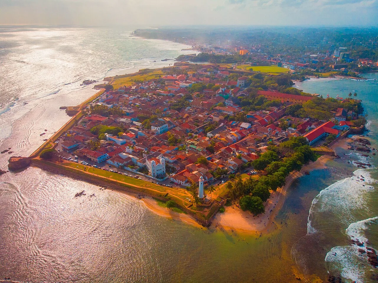
Galle Fort provides a coastal heritage example for comparing place names, settlement and landscape.
Describe categories precisely without converting a national label into a claim about every resident. Sinhala, Tamil and English are relevant language names in Sri Lankan contexts, while LKR identifies the Sri Lankan rupee. Language use, legal status, everyday communication and personal identity are related subjects that need different kinds of evidence.
A language heard in a neighbourhood is not necessarily the language used on every official form. The language of a visitor page also cannot establish what every household speaks. For legal statements about language status, use the current constitutional text rather than inferring a rule from a tourism description.
Currency names deserve similar care. Sri Lankan and Pakistani rupees have different codes. An amount marked only “rupees” is incomplete when comparing countries. Retain LKR or PKR as appropriate, keep original units in your notes and use a dated rate for any conversion.
Cultural heritage includes places, practices and the meanings communities attach to them. Identify the particular festival, building or tradition and describe its relevant setting. An example can introduce diversity without standing in for every resident's experience.
A respectful photograph caption identifies what is visible, where it was taken and when, if known. Avoid guessing someone's religion, ethnicity or profession from appearance. A source's uncertainty should remain visible when you paraphrase it.
One useful classroom task compares a museum description with a visitor description of the same site. The museum may emphasise historical interpretation while the visitor material concentrates on access. Compare their purposes and strengths. Neither source automatically answers every statistical, cultural or legal question simply because it discusses the same place.
Why do cricket searches need their own explanation?
A Sri Lanka cricket search concerns a particular team, fixture or competition; a geographical profile concerns the country and its places. Keep records in a distinct section. A national team's performance tells you about a defined sporting contest, not the whole society represented by the team name.
Begin a match note with team category, opponent, format and date. Men's, women's and age-group teams have separate records. A scheduled fixture differs from a completed scorecard. These distinctions matter more than whether a promotional graphic abbreviates the country's name.
Suppose a search result places a tournament table beside a country map. The positions in that table describe competition performance under particular rules. They do not rank national education, tourism or economic development. An explicit heading protects readers from carrying the wrong meaning between the two displays.
Sport can still enrich geographical learning. Locate a venue, compare it with another city and investigate the route between them. You can discuss distance, transport and regional connections without inventing a match result or attendance figure.
Use the relevant sporting authority or direct interview for a squad change or player quotation. A tourism portal is not the primary source for selection. Conversely, a cricket board's match report is not the best evidence for a national population total.
The distinction improves both parts of a profile. The geographical section supplies spatial context; the sporting section explains an event. Readers interested in either subject receive the answer they need without inheriting claims that belong to a different category.
How can a student build a reliable one-page profile?
Choose a small set of questions, assign an appropriate source to each and keep statistics dated. A useful profile combines a location map, clear place names and explained facts. Quality depends on how evidence supports the claims rather than how many disconnected numbers fit onto one page.
Use this comparison when selecting information:
| Research question | Suitable starting evidence | Essential label |
|---|---|---|
| Where is the island? | Regional atlas | Surrounding water and scale |
| Which city serves which function? | Official country description | Exact functional role |
| How many people were counted? | Census publication | Year and geographic unit |
| What happened in cricket? | Official scorecard | Team, date and format |
| Can a visitor enter? | Immigration authority | Current eligibility conditions |
For population density, keep numerator and denominator compatible. A population measured within one boundary cannot be divided by the area of a different boundary without changing the calculation's meaning. Display the unit, such as people per square kilometre.
Distinguish an observation, estimate and projection. A projection models a period rather than counting residents anew. Copying a figure without its classification can make even an accurate original source misleading.
Write research cards in your own words before compressing them into a page. Each card should retain its source, date and exact geographic subject. If two sources disagree, compare their definitions and publication dates before choosing one.
A concise conclusion should connect the map with the profile's purpose. Explain why location matters for the chosen question, such as coastal travel or regional comparison. That relationship makes the exercise educational rather than a catalogue of attractive facts.
What final checks prevent naming and map mistakes?
Read the completed profile once for meaning and once for labels. Confirm that the full country name appears early, the map covers the places discussed and every changing figure retains its unit and date. Historical terminology, literary material, sport and modern geography should remain recognisable wherever they appear.
Ask another learner to explain the profile using only its map and captions. If they cannot tell which city function you mean or which year a statistic describes, improve the label before adding more detail. This tests the information structure, not the reader's ability to guess.
Check transliteration consistently. Place names sometimes have several English forms, but unexplained switching distracts readers. Select one published form for the main text and record a variant only when it aids recognition or research.
Review travel planning separately from stable location facts. Current immigration guidance, transport availability and site access need their own checks. An old brochure can help illustrate how a place was presented, but its practical arrangements cannot simply be carried into a new trip.
Finally, revisit the original question. Someone asking where Lanka is needs an immediate location answer; someone researching historical names needs source-specific interpretation. A clear opening and well-labelled sections can serve both while preserving their different interests.
Keep a brief research log containing map edition, publication date and unresolved issues. When a source changes, the log lets you update the affected claim without rebuilding the whole profile or forgetting the reason for the original wording.
Sources
Image credits: Cover: Earth Science and Remote Sensing Unit, Lyndon B. Johnson Space Center, source, Public domain. Resized and converted to WebP. Article image: Rovin Shanila, source, CC BY-SA 4.0. Resized and converted to WebP.
Result dates, fees and eligibility must be checked against the issuing authority's current notice. Report a correction with the article URL and original source.